What is a microburst?
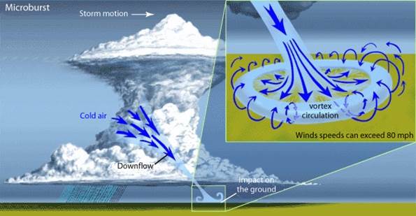
It is a localized column of sinking air (downdraft) within a thunderstorm, typically less than or equal to 2.5 miles in diameter. Microbursts can cause significant surface damage and, in some cases, pose a threat to life.
There are two primary types of microbursts: 1) wet microbursts and 2) dry microbursts. We and accompanied by significant precipitation and are common in the Southeast during summer months. They can have tremendous wind, hail and heavy precipitation within a few minutes, with wind reaching 100 mph or higher.

What causes a microburst?
It all starts with the development of a thunderstorm and the water droplets/hailstones being suspended within the updraft. Sometimes an updraft is so strong it suspends large amounts of these droplets and hail in the upper portions of the thunderstorm. There are many factors that can lead to evaporational cooling and therefore, weakening of the updraft. Once this occurs, it is no longer capable of holding the large core of rain and hail up in the thunderstorm. As a result, the core plummets to the ground. As it hits the ground it spreads out in all directions. The location in which the microburst first hits the ground experiences the highest winds and greatest damage.
Our own experience.
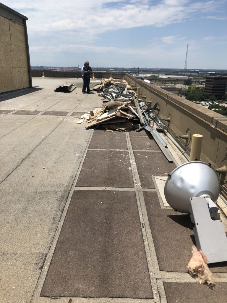
Texas Weather never disappoints if you are looking for variety. Last week on June 9th, there were several areas around DFW with buffeting wind, hail and microbursts. One of the properties we are currently working on had one such microburst that came and went within a matter of minutes, but did extraordinary damage. This midrise building had walls literally sucked out, paint peeled off siding, twisted metal, damage to the roofing system, downed trees and a whole laundry list of damage. The weather predictors never mentioned the term “microburst” but it certainly left its mark on the area around north Dallas at LBJ and I-35E. The pictures tell the story of the incredible power of one of these fast-moving storms.

